Saturday, January 18, 2014

Ternate LSD

January 18, 2014
Saturday, Its a nice day to conduct a weekend LSD. 
Today LSD will be on Cavite-Batangas but this is not an ordinary LSD since we will we will be pass by Mt. Pico de loro Traverse (yup, we will be hiking/trek along Mt. Pico de loro traverse trail).

We started our training around 5:20am at the Ternate Bus stop station. We left some of our things at one of the carenderia there.

The route is a hell of a kind uphill challenge. We run to DENR for almost 1hr 30mins. We rest for a bit and we saw a group of people (doing a company activity at Pico de loro). Ternate bus stop to DENR distance is 9.2km. After eating boiled egg, bread and banana (breakfast) we continue our LSD but this time we do some trek since we will be going to Mt Pico de loro.
TAPIK Trail Runners at Pico de loro

We do the trek upto the campsite of Pico de loro for another 1hr 30mins, we do some photoshoot. We also saw Martin at the campsite and rest at the store there, drink some Mountain Dew, eat some trail food that we brought at the DENR. After doing some photo shoot at the campsite. We decided to climb the summit and did some photo shoot at the summit. We climb the monolith of Pico de loro afterwards (We do some rock climbing Yey!). After the monolith climbing, we continue the traverse of the Pico de loro upto Nasugbu. Martin decided to come along with us since he will be doing his solo Nasugbu Trilogy. Along the way to Nasugbu, we encounter a group of mountaineers that will be doing their nasugbu Trilogy also. We told Martin to join them so that he will have some acquaintance to Talamitam and Batulao. Pico de loro traverse distance is 9km.

We reach the Nasugbu road around 11am. We rest again for 10-15mins then starting running again to DENR. This time the route is not that easy since it will be a heat training. We will be running under the heat of the sun (hot). Along the road we took a rest at one of the store to drink some Coke. After drinking and do some fast rest we continue our run to DENR. When we are near the Kaybiang Tunnel we saw a woman at one of the corner of the road selling dirty ice cream (com to think of it, at the middle of the road a woman selling dirty ice cream, she said she was from Ternate and went there to sell dirty ice cream). After the ice cream moment ewe continue to run to DENR and we will be passing the Taybiang Tunnel which is almost 400 meter long tunnel. After the beautiful tunnel experience we continue our run upto DENR. We reach DENR around 2pm, distance from Nasugbu to DENR is 11km
Dirty ice cream moment with ate Julie

Kaybiang Tunnel


Exhausted Runners at DENR
     After resting at the DENR, we continue to run for the last 9km (Yes!). We will be going back to the Ternate bus stop running downhill, after the uphill in the morning, we will be running downhill in the afternoon. We reach the Ternate Bus stop around 3:30pm our total time is 10hrs. Its a 10 hours of run walk hike LSD. Congratulation to my fellow Ternate LSD Jullius, kuya Argie, Lui and John(Countryboy Tugade).  Total distance 38.3km LSD.
Ternate - Pico de loro - Nasubgu, Ternate Route


Friday, January 17, 2014

3 Days Solo LSD

It was a Sunny and nice weather to run, as part of my goal this year, I join the 2014km Club which aims to finish 2014km until December 2014. 

As of January 16, total of 126.4km 
January 2 - 11.1
January 6 - 9.8
January 7 - 10.9
January 8 - 9.6

For January 14-16, I do a 3 day Solo LSD

January 14 - Valley Golf Uphill Challenge
This LSD is basically around the Don Celso Tuason Road along Valley Golf, I did 3 laps of uphill the downhill from gate to gate of Valley Golf. I call this uphilldownhill3x this run has a distance of 24.2km.


January 15 - Cubao-Antipolo via Sumulong-Ortigas Avenue-Valley View
My second Solo LSD, this time after I reserve my bus ticket to Vigan since I will be joining the Ilocos 160 on January 25-26, I make this an opportunity to run again, this time I run from Cubao all the way to Marcos Hi-way, then straight to Antipolo which is an uphill, then visit to Antipolo Church, then back to Valley View using the Ortigas Avenue. I started this activity around 1030am (heat training for me) This run has a distance of 28.8km. (I lost my data in Nike+ for this run, I don't know why)


January 16 - Valley View-Valley Golf Sumulong-Cubao-SM MOA
My third Solo LSD, this time I run from valley view upto SM MOA but I use the longer route with a distance of 32k. I started running by 6am in the morning and reach my destination by 10am (saktong bukas ng mall). There are 3 possible way to go to SM MOA from Valley View, using the Ortigas Ave - EDSA - MOA or Ortigas Ave - C5 - BGC - EDSA - MOA, both route has an equivalent distance of 23km. The route that I use is much longer. I run using the Sumulong Hi-way all down to Marcos Hi-way to Cubao then use the EDSA upto SM MOA. My another agenda in SM MOA is to go to Sony Experia to check my battery, but sadly they are not authorize to do checking or repair and gave me the address of their authorize repair/maintenance which happen to be in Kapitolyo, Pasig City.  I think there is an error in the distance since the 22km & 23km has far interval, this is because of the weak GPS along Robinson Galleria upto Guadalupe Area due to the buildings and covered roofings that blocks the phone. This run has a distance of 32km.


My next LSD will be on Saturday, January 18 which will be in Ternate, Cavite with some friends.

Thursday, January 9, 2014

Ilocos 160 and Ilocos 102

Ilocos 160K (Vigan to Pagudpod) - January 25, 2014
Ilocos 102K (Currimao to Pagudpod) - January 25, 2014

This coming January 25, BRC Events organize its Ilocos 160 and Ilocos 102.

160K Ultramarathon from Vigan City, Ilocos Sur to Pagudpud, Ilocos Norte.

102K Ultramarathon from Currimao, Ilocos Norte to Pagudpud, Ilocos Norte

Cutoff:    160K - 36 Hours

              102K - 21 Hours

Gunstart: 160K - 3AM Provincial Capitol, Vigan City, Ilocos, Sur
              102K - 4PM INEC Office, Lang-ayan, Currimao, Ilocos Norte


Support Vehicle/Crew: Recommended but not required. There are many 24-hour Convenience Stores along the route.

Water/Food Station: Besides the mobile hydration, there will only be one water/food station - it will be located in Laoag City.

Pacers and Walking Sticks: Pacers and Walking Sticks will only be allowed from Laoag City onwards.

NO CASH PRIZE! NO LOOT BAGS! JUST PURE PAIN AND FUN!
 

Sunday, January 5, 2014

Color Manila Run 2

Color Manila Run 2


The most colorful fun run of the year. Its great to start the year with wonderful run at Colors Manila Run 2. The event was composed of 3k, 5k and 10k category. Different ages and nationalities join the most epic run of the year as they was splash with powdered color as they run in the road. Thousand of runners participated in this epic run. Runners start their run with white colored shirt and run in the road and must pass by some color booths. Different colors that runners must pass by are pink, blue, yellow, green, orange and violet.

Each color booth has different theme, they have castled themed booth, festival booth, superheroes booth etc. to add up the excitement in the run.  This is one epic run of the year since runners are not contented by the powder that the booth marshal throw, they get some and throw it on their friends, some roll at the road to gain colors, some lay down in the colored road.
Runners lay down on the colored powder

5K U-turn slot
I was assigned as a marshal in the yellow booth, I arrive at the football field around 2am since it was the said calltime and we must wear yellow shirt and must bring a mask (i don't have a mask) but our leader told me that it is ok if i don't have mask, just wear yellow shirt. When we arrive the area, we waiting some time waiting for the signal of the coordinator to bring us to our booth location. Around 4:30am, we arrive at our booth location, our location is at the u turn slot in the 5k category.

Yellow Flag at the yellow booth
 
Only the 5k and 10k category pass our booth, you can see the happiness of the runners while running at the road. You see their shirt with different splash of colors. Even if we are returning to the venue using a truck, runners are willing to be splashed by our yellow powder. Runners want to get their shirt colorful as they could, combining different colors and leaving no trace of white in their respective shirt. Runners don't care about the ranking, all they care about is being dirty with colors with fun and excitement.

Runners after the run assemble in the field, as the host count from 1, 2 and 3 runners throw there colored packet and VIOLA! Cool colored powder painting the air.

Photo from Running Photographers Facebook page; photographer:RJ Knight Runner

It's a nice experience to join and participated in this one of a kind epic run of the year. Kudos Proactive for organizing this run. Til the next Color Run (Night Run at Alabang, this February 2014).

Saturday, January 4, 2014

Mt Sembrano Dayhike

January 4, 2014
First journey ng taong 2014, Mt. Sembrano.
Mt. Sembrano is located at Brgy. Malaya, Pililia, Rizal.

I will never forget my experience in Mt. Sembrano. We almost lose in the forest along with my friend. We didn't get a guide in order to go to the mountain since the brgy. personnel told us that the trail is easy and must turn left at Licudan st and just walk straight then right at the Manggahan area. Both of us didn't know the area since we are new in the area. My friend is a first timer hiker and he just want to experience new things. 
         

Nipa hut along the trail
As we arrived in the barangay hall we register for Php 20.00, they also get our number in case of emergency. As we walk to Mt. Sembrano we didn't know that we have to turn right when the first nipa hut, we just walk and walk until a man told us that we are far from the trail to Mt. Sembrano and need to return from the nipa hut. He also told us that we have to pass by the bukohan. As we return to the nipa hut, we saw a man and ask where to Mt Sembrano, luckily he told us the right way. As we continue our walk to Mt. Sembrano, we encounter a group of mountaineers descending from their climb. They are from Pililia Rizal that conduct their camping at the summit. We asked them if the way is easy to track and no "ligaw" trail, they told us that it is easy.

 Group of mountaineers from Pililia Rizal
We continue our walk and reach the what they call "Manggahan", the manggahan area is a private place thus we need to pay Php 20 as a fee as we enter the premises. After passing by the manggahan area and continue walking, we encounter bouldering. This bouldering is quite tricky as we got lost again for the second time around, we didn't know that there is a right turn again at the bouldering. We reconnect again the trail and found the real trail to Mt. Sembrano.
 Manggahan (private property)
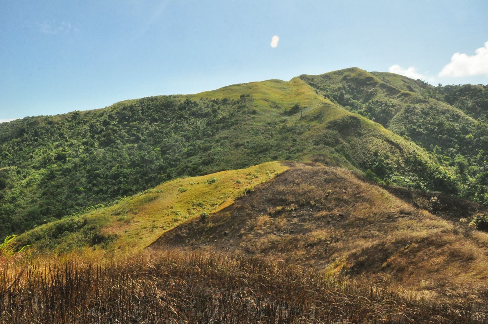
After those lost and found experience we reach the grassland where you can see the north and south peak of the Mt. Sembrano. We though that we can't reach the top but thanks God for keeping us believe that we can reach the summit. When we reach the grassland of Mt. Sembrano, I feel disappointed from what I saw. Part of the grassland where being fired as they conduct "kaingin" in the area. As we go to the South peak we encounter a group of mountaineer descending from their day-hike adventure.

 Mt. Sembrano's grassland

We walk for around 4 hours in order to reach the summit of Mt. Sembrano and took some memorabilia (pictures) at the top. You can see the Laguna de Bay at the top, other part of Laguna like Sta. Cruz. You can also see Talim Island and mountain Mt. Makiling located at Los Banos, Laguna.


View at Mt Sembrano's grassland

View from Mt. Sembrano's Summit; Pointing at Mt. Makiling

 Views from the Mt Sembrano's Summit; right side: Sta. Cruz, Laguna

Group of mountaineer resting at manggahan area
After some picture taking at the top, we decided to descend. When we reach the manggahan area, we saw the group that we saw at grassland drinking buko juice that kuya freshly get from one of the coconut tree in the area. The coconut was sold for only Php 10.00. We decided to take a rest before going to the Manggahan Falls which is just a minute away from the manggahan area.


Mountaineer preparing lunch near the falls

 We continue our journey at Mt Sembrano, we go to the manggahan river that is a minute away from the manggahan area and saw another set of mountaineer preparing their lunch. We just refresh for some time and took some picture and decided to go down the mountain.

  We walk and walk until we reach the town, tiring but priceless. We go to the barangay hall to tidy up before leaving the barangay. We eat our lunch at Jollibee Tanay.

Mt. Sembrano Route and Elevation


ITINERARY
0530 Assembly at Valley Golf, Cainta, Rizal. Take jeep to Tanay, Rizal
0630 ETA Tanay Rizal; take jeep to Pililla (there’s a queue of jeeps in the terminal)
0730 ETA Brgy. Malaya, Pililla (jump-off). Register.
0745 Start trek
0930 ETA Manggahan
1045 ETA North Peak
1130 ETA South Peak (summit)
1150 Start descent.
1315 ETA Manggahan Falls.

1445 Back at jump-off, tidy up then take jeep back Tanay
1630 ETA Manila